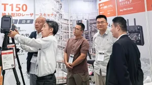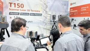
High-precision engineering projects require repeatable and reliable 3D data. Static terrestrial laser scanning provides a stable approach for complex sites because scans from multiple stations can be registered into a consistent point cloud.
To meet demand for an accessible professional system, EPiC LiDAR has introduced the EasyScan T05, the second generation of its EasyScan T Series. The scanner combines high accuracy, automated workflows and straightforward operation in a compact design.、
Integrated Design
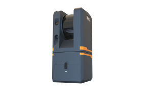
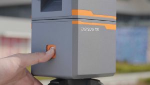
The T05 integrates its battery and cameras into the main unit, eliminating external power modules and exposed cables. The scanner weighs 3.7 kg and can be operated by one person with a tripod, transport case and mobile device.
Efficient Field Capture
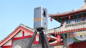
Operators can control the scanner from a mobile device or directly from the unit. Scan and image settings can be configured at the first station, after which one-button capture supports a consistent field workflow.
Each smart battery supports more than 50 stations of continuous capture, and two batteries are supplied as standard. Data is written directly to a USB drive for transfer to office processing.
Automated Processing and Registration
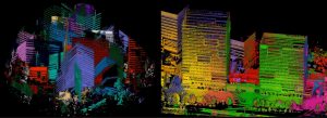
EPiCloud Center, EPiC LiDAR’s processing software, supports one-click import and automated processing for multi-station projects. The workflow includes scan processing, panorama generation, noise filtering and RGB colorization.
The T05 integrates tilt, inertial and altitude sensors to support automated multi-station registration. These measurements, together with geometric feature matching, help the software determine the relative position of adjacent scans.
Measurement and Color Quality
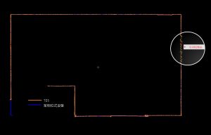
The T05 delivers millimeter-level ranging performance and pixel-level colorization. Comparative testing reported repeatability of 5 mm, relative ranging accuracy of 5 mm at 50 m, and absolute ranging results with 90 percent of points within 3 mm and 97 percent within 5 mm.
Three integrated cameras produce 66-megapixel panoramas. EPiC LiDAR’s calibration and processing workflow aligns panoramic imagery with point clouds for consistent colorized output.


The T05 has completed third-party testing for CE and FCC compliance, RoHS, temperature, shock and vibration, as well as measurement accuracy. It is designed for tunnel surveying, facade documentation, heritage conservation, power infrastructure, stockpile measurement and digital twin projects.

EPiC LiDAR develops terrestrial and airborne 3D LiDAR systems for surveying, public safety, building information modeling, power infrastructure, industrial measurement and urban digitization. The company will continue to improve the accessibility of high-precision 3D data acquisition through independently developed hardware and software.